Diversions
/
Trip Report
Rocky Mountain Casual
After a busy summer, we sneak in a quick weekend to Colorado and get some help uphill.

With everything 2022 brought—a move across several states, a new job, and wedding planning—I was pretty happy with how much we’d managed to keep doing throughout the year. We both kept the mileage up on our bikes, hiked parks near our new home, and discovered many corners of Cincinnati by foot and bike. Yet, we made it into fall with a honeymoon still in the distant future and no other travel plans. Even if we didn’t have much vacation time to burn, we knew it’d be good to get away for just a couple of days.
In addition to some adventure, we knew it’d be great to spend some quality time with friends who we saw too briefly on the weekend of our wedding. Over the years, many friends departed North Carolina before us for exciting spots like Colorado, Utah, and Alaska. With only a few days to squeeze something in, Colorado seemed like an easy choice as a destination. After a bit of planning with Oakley and Laura—two great friends, former roommates, and the reason for anything I’ve ever done that resembles rock climbing—we were booked. We’d spend a few days exploring Rocky Mountain National Park in late September, a time in which we hoped to catch the elk rut and peak Aspen foliage but miss the arrival of winter in the mountains.
Our weekend was bookended with good food and urban strolls through Boulder and Estes Park and peppered throughout was downtime with our friends. I’ll save any takes on restaurants, breweries, and the feature film Lightyear for another time (never) to focus on the main events of the trip: a hiking tour of alpine lakes and a slightly assisted bike ride to the highest visitor center in the National Park system.
First, we hiked. On our first full day in Colorado, Frances and I set off with Laura to the Bear Lake trailhead. Our goal for the day was a hike linking up a handful of alpine lakes in the eastern part of the park. It was a clear morning, though the temperature dropped quickly as we ascended and I knew conditions could change quickly. One of the best things about the hike was quickly apparent—this wouldn’t be a long trudge to finally reach a viewpoint, but we’d be gifted with great scenery all along the way. The first lake on the list, Bear Lake, was mere steps from the trailhead. While it’s easy to access, Bear Lake isn’t any less worthy of visiting. While a particularly good vantage point was crowded with photographers who’d arrived before sunrise to set up their tripods, we were able to walk a few yards further and enjoy the first golden rays of sun as they hit the treetops.
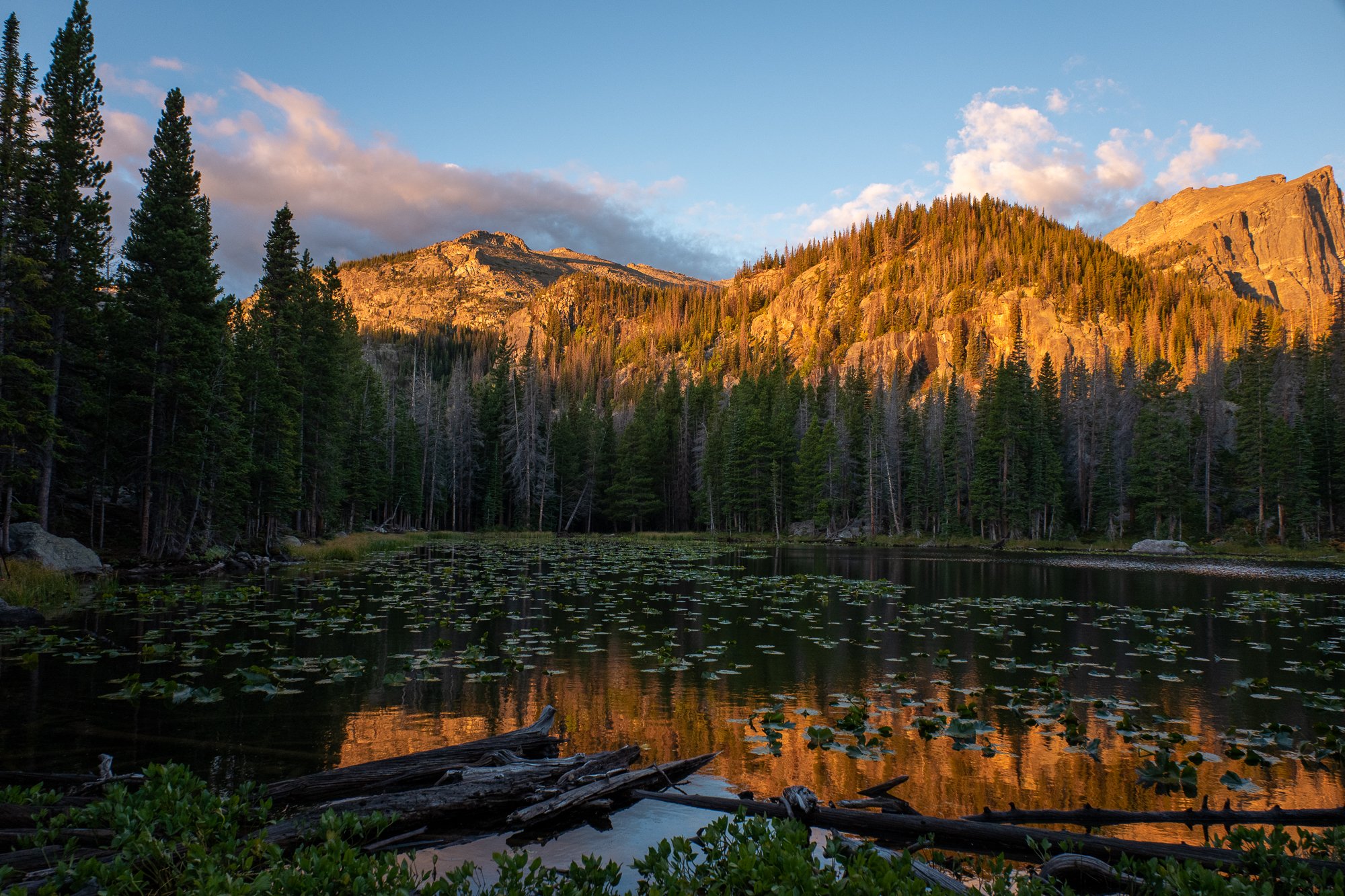
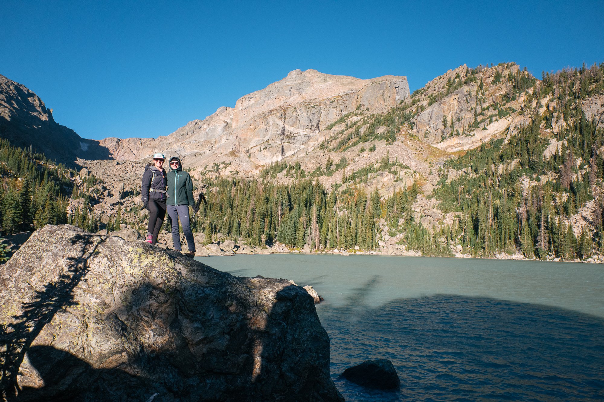
I would’ve loved to stay and watch the sunlight inch its way toward the lake’s surface, but we had more to see. Next up was Nymph Lake—the smallest we’d visit for the day—then Dream Lake. The view from the eastern end of Dream Lake looking west toward Hallett Peak is spectacular and a common photo spot for a reason, but I especially enjoyed the shifting views of the lake and surrounding peaks as we hiked along its northern shore. The trail continues past Dream Lake three-quarters of a mile to Emerald Lake. As we made our way there, however, we encountered a doe elk with her calves in tow near the trail. Out of an abundance of caution, we decided to turn back and give them their space; there were other lakes for us to see anyway. Once back on the other side of Dream Lake, we made our way south to Lake Haiyaha, which offered a unique sight. Earlier in the year, a nearby rockslide deposited glacial silt into the lake, temporarily making its waters an opaque turquoise. This color would eventually fade as the minerals settle and run out of the lake so it was a treat to see it in this moment.
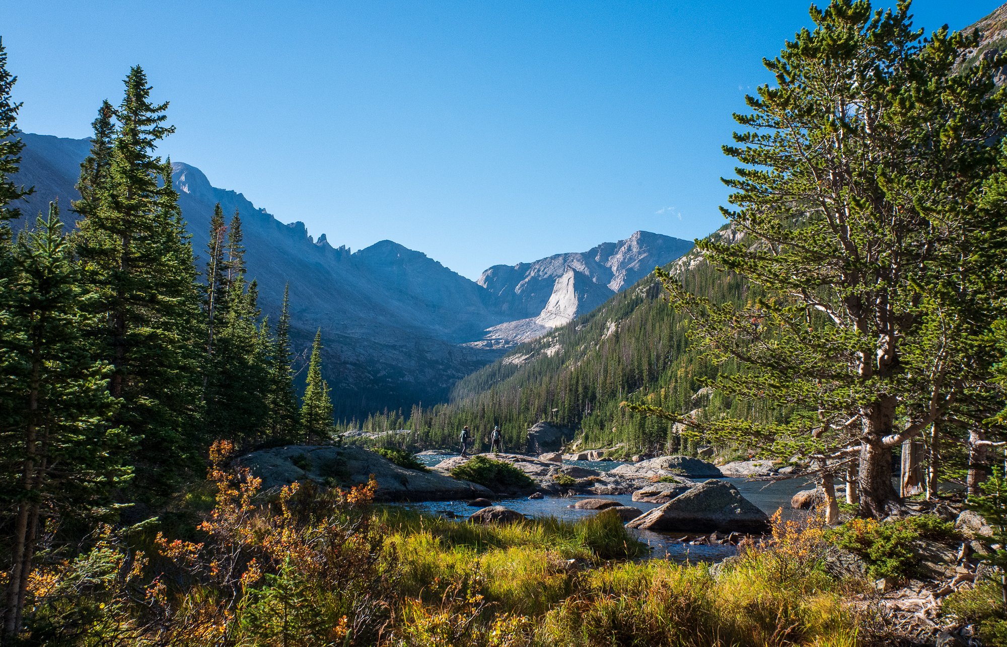
The wind began to pick up as we scrambled around the rocks surrounding Haiyaha and having light jackets, we retreated to the shelter of the trees to continue our hike. Ahead laid the longest stretch of hiking between lakes we’d have for the day before a final stop at Mills Lake. Along the way, we passed several trail junctions that offered a chance to see many more lakes, peaks, and gorges. I was glad we had Laura, who has hiked nearly all of these trails since they moved to Colorado, to curate our points of interest. Skirting around the lower portion of Thatchtop’s peak, we arrived at Mills Lake with a view extending up to the northern ridge of Longs Peak in the distance. Back in 2016, I hiked to Chasm Lake on the other side of Longs Peak with Oakley and Laura and it was fun to see it from a different angle, recognizing certain features though I now saw them from a new-to-me angle.
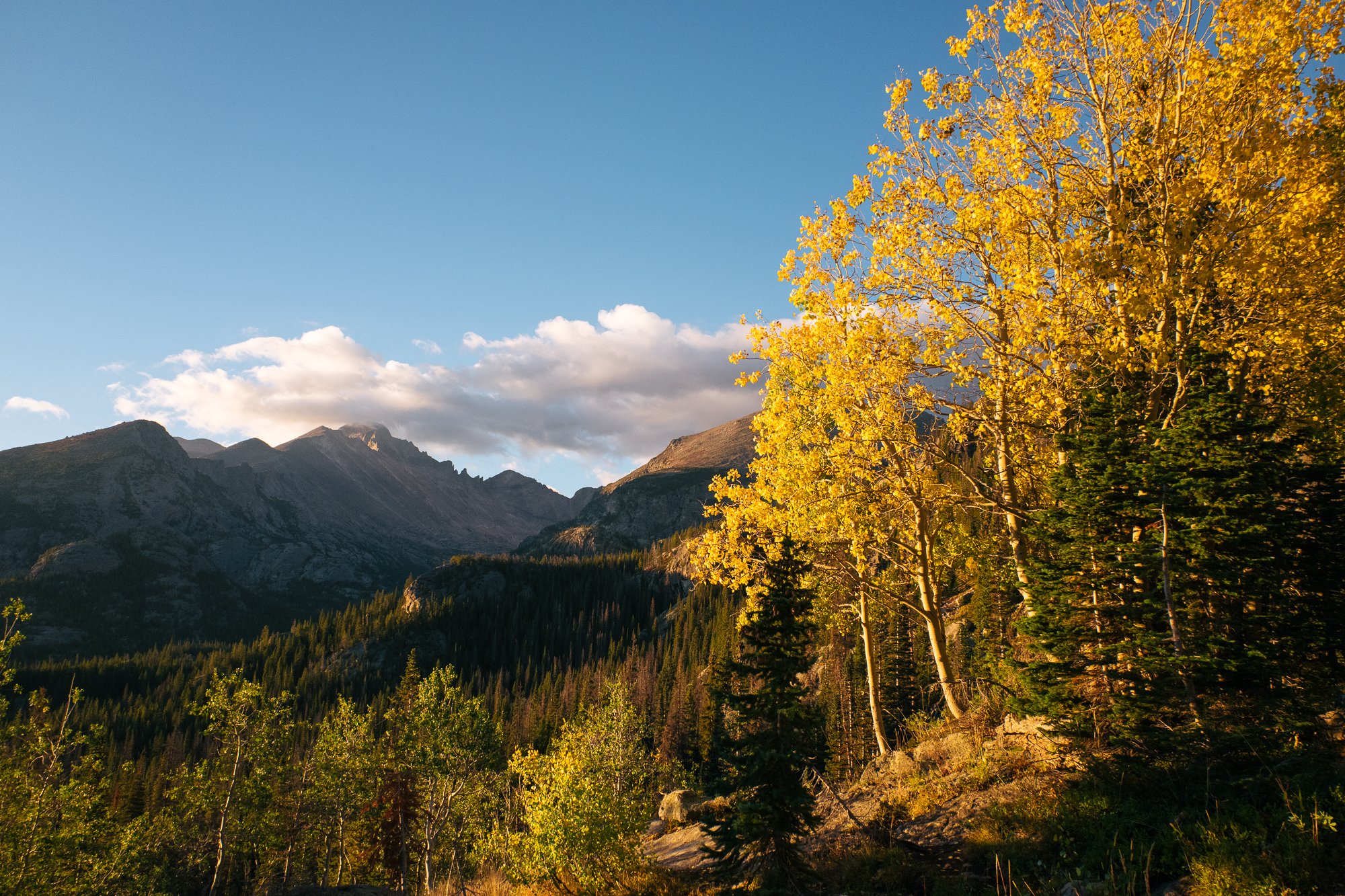
After soaking up the views of our final lake for the day, we began our descent through the forest back to the trailhead. As amazing as all the vistas were, I enjoyed hiking in the dense canopy of evergreens just as much; the smell is something I had really missed. To our delight, we also came upon a few pockets of vibrant Aspens. Many of the largest groves were yet to reach their peak color and other exposed trees had been stripped of their foliage by the wind, but it was a treat to catch a glimpse of this fleeting annual phenomenon nonetheless. We returned to the car with just shy of 8 miles and 1,200 feet of elevation gain under our feet. The theme of great views for only moderate effort was just getting started.
I finished the first day with a quick lap of some local singletrack with Oakley. I know it's a disservice to generalize mountain biking “out West,” but I always marvel at the feeling of more open singletrack here. While the trail itself is no wider, the stretches of sloping rock flanked by low brush are so different from the hard-packed clay trails weaving between tree trunks I grew up riding in the Southeastern U.S. I’m not sure whether the ride served as a warm-up for the next day or ensured my legs would be fatigued, but it was fun.
While we climbed a bit on our hike, we spent the day looking up at the peaks of the Rocky Mountains from below the treeline. The next day, we’d go up there.
* * *
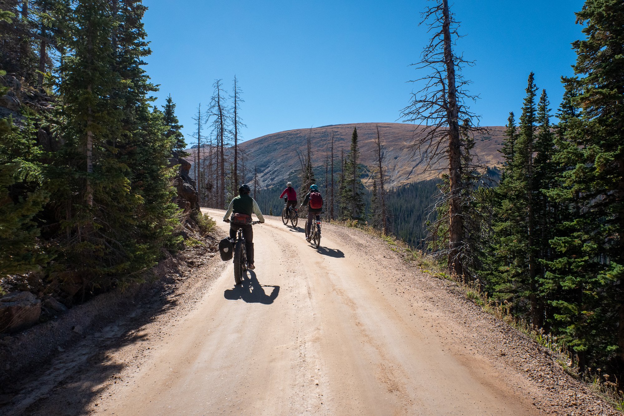
Old Fall River Road opened in 1920 and was the first auto route in the park to access the high country. Today, most park visitors reaching the Continental Divide take Trail Ridge Road, the highest continuous paved road in the country, but Old Fall River Road remains open seasonally for anyone looking for a more scenic gravel route. The road is open to automobiles but is one-way and has a relatively low speed limit, which makes it a bit easier for cyclists to navigate. Oakley recommended we ride up Old Fall River Road to the Alpine Visitor then descend Trail Ridge Road to return to our starting point. The route would travel a bit over 30 miles and climb nearly 4,000 feet. In addition to stopping by the highest visitor center in the National Park system, we’d go over the highest point of Trail Ridge Road at 12,183 feet above sea level. While the actual Continental Divide lies further west on Trail Ridge Road than we’d venture, this seemed like plenty of climbing—maybe too much climbing for someone who hasn’t been doing it regularly and has been living a few hundred feet above sea level. The solution to keeping our fun excursion from becoming a sufferfest: e-bikes. We called the local gear shop and inquired about the range of their rental bikes. They thought we should be able to make the climb if we kept the pedal assistance to a minimum. It was worth a shot.
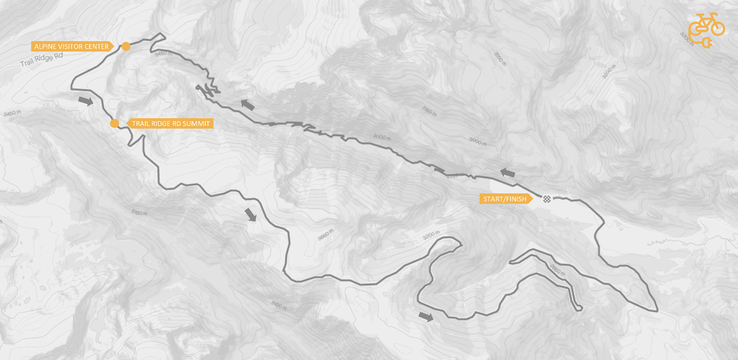
With a healthy dose of optimism, we picked up our rental bikes the next morning and set off for the park. Parking near the eastern terminus of the road, we began with a short section of flat grade to settle in and get used to the electric assistance of the bikes. I’d ridden an e-bike only a few times before and had never taken them on any significant grade, so it took a while to get used to the sensation of going uphill a bit faster than it felt like you were pedaling. Getting up the gradual, winding gravel road still took work, but it required a level of exertion that still allowed us to enjoy the views and talk. Truly, it was a perfect balance. We resolved to keep the pedal-assist at ‘1’ to conserve battery; even at this level, I found myself periodically checking the battery meter and estimating the miles we had left to climb.
Somewhere around midway on the climb, I watched the first segment of the battery icon disappear and I began to feel a little less optimistic that it’d last the entire ride. I wouldn’t need the battery at all for the descent but if it died any sooner, I’d suddenly have an unnecessarily heavy bike to get to the top on my own. We kept winding our wall uphill, taking in views along the way. With the visitor center in sight, we made a final push up the last of Old Fall River Road. The terrain at this point was really spectacular. Perhaps it’s something you grow accustomed to if you see it often, but the chartreuse carpet draped over rocky tundra always gets me. I coasted to the entrance of the visitor center with a single battery segment left illuminated on my handlebar display. There was still a mile or two of climbing left on Trail Ridge Road, but I pushed that to the back of my mind and ducked into the building for some warmth and a mediocre snack.
Once we warmed up and had our fill of hot cocoa, we returned to our bikes outside to finish the ride. I woke the electronic components up to find an empty battery icon flashing then the display went dark. I tried again and got an error message. Beginning to panic a bit and dreading a couple miles of climbing alongside traffic with a dead battery, I tried once more: one solid rectangle was now displayed on the battery. Not trusting its own estimation of power remaining but thankful that it seemed to have something left to give, I pedaled out of the parking lot and met up with Frances, Laura, and Oakley. There’s little to no shoulder and definitely no bike lane on Trail Ridge Road so I was careful to not get too lost in the scenery as drivers of varying skill levels, questionable reverence for traffic laws, and seemingly little familiarity with the space their rental cars occupied made their way around us. Reaching the highest point along Trail Ridge Road, we coasted into the pulloff for the Lava Cliffs Overlook to allow ourselves a moment to take it in without worrying about drivers approaching from behind. From here, we faced a nearly uninterrupted 18-mile descent.
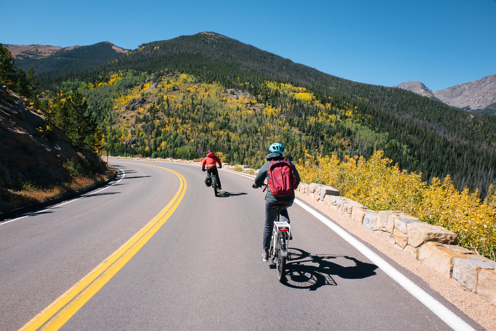
While I averaged over 20 mph on the way down, the pedal-assist seemed to keep our speed in check to a degree. I didn’t mind so much as we were moving along at a nice pace and I didn’t want those 18 miles to pass too quickly with so much to see. The views from Trail Ridge Road really are spectacular, even from a car. I remembered several of the overlooks from a drive years back when Laura drove Oakley and I back over the divide from an incomplete attempt to run from Bear Lake to Grand Lake and back (something I’ll keep on my bucket list), but seeing them now from the bike was even a bit better than the views I remembered from a car. Eventually, the grade began to ease and we slowed to turn back to the trailhead where we’d parked. Despite our long, leisurely descent and the pedal-assistance we received on the way up, I felt a sufficient sense of achievement. If you worry that riding an e-bike will diminish the enjoyment of a post-ride beer, I can assure you it will not.

We completed a quick hike on the outskirts of Estes Park the next morning before making our way back to the airport. Arriving back in Ohio and preparing for work the next day, I wasn’t sore and resigned to return to a desk chair the way I have been after some weekend warrior pursuits. Instead, I only felt reinvigorated from spending time with old friends and soaking up the vast and rugged landscape of the Rockies. Perhaps there’s some merit to not pushing yourself too hard.


