Diversions
/
Trip Report
Bikepacking Ohio
Several months into the COVID-19 pandemic, my girlfriend and I escaped the house to ride through Appalachian Ohio on our first bikepacking trip together.
Duration
4 days
Total Distance
267 miles
Elevation Gain
9,117 ft.

The Plan
We already had big plans to take our first overnight bike trip together in 2020. After attending our friends’ wedding in Wisconsin, we’d spend the next few days on a loop through the nearby Chequamegon-Nicolet National Forest. When the wedding was postponed, we decided not to head all the way to Wisconsin but were still determined to take a tour of some kind. We researched and subsequently ruled out several routes that didn’t allow us to safely distance ourselves and protect the small communities we would pedal through. Finally, we settled on attempting the second half of Sarah Swallow’s Buckeye Bicycle Route (the full length of which runs from Cincinnati to Cleveland). With help from Frances’s parents, we would be able to get to our starting point near Logan. From there, we’d follow the route on a mix of pavement, dirt, and gravel to end in Cleveland.
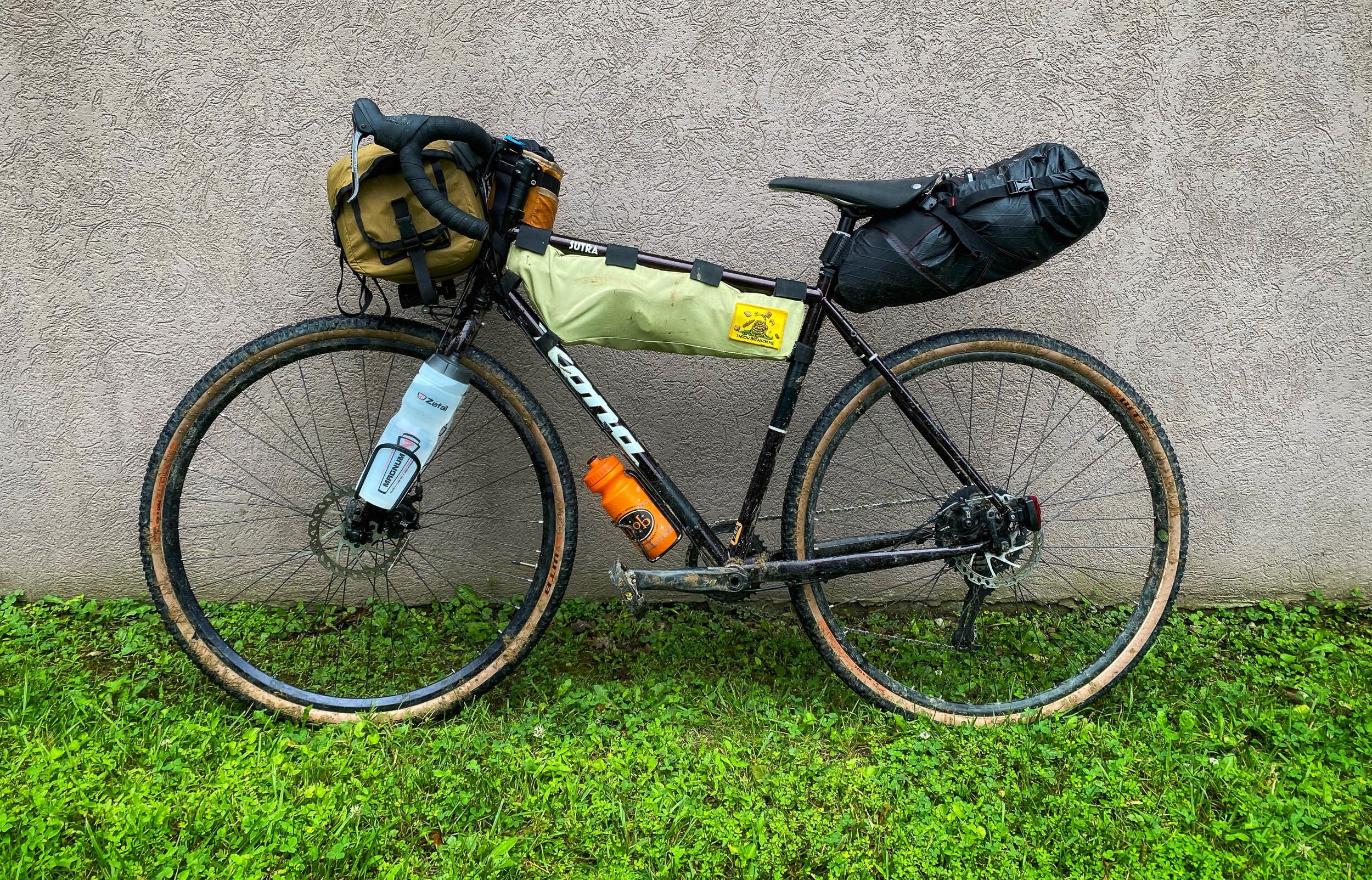
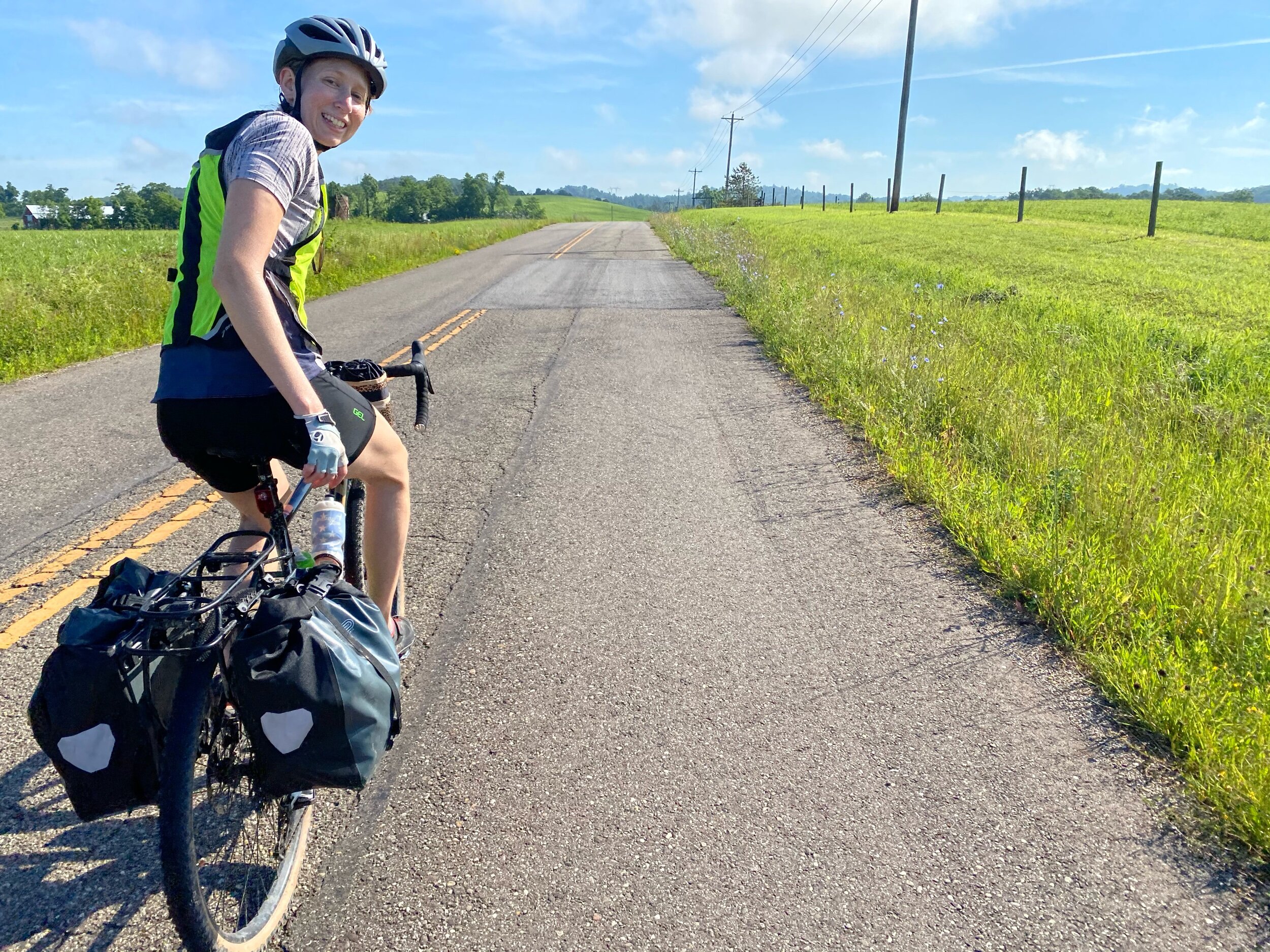
Next, came the first real challenge of bike touring: how to carry everything. To start, we had chosen to take my trusty Kona Sutra and Frances’s new Rove ST, both versatile, steel frame rigs with a generous tire clearance that could handle the mixed terrain even while loaded down. I opted to carry most of my gear in bags on the handlebar and saddle; Frances went for a rear rack with panniers. With just a few substitutions and the addition of a basic repair kit, our gear list was similar to what we have taken on multi-day backpacking trips. A couple of test rides around the neighborhood allowed us to shift some of the weight around in our bags to improve the bikes’ handling and stability. Soon, the week of the trip arrived and we drove up to Ohio.
Day 1
Frances’s parents dropped us off at Lake Logan State Park, where we began our ride in a light drizzle. Being left there with plans to be almost 300 miles away in four days suddenly made me question if we were too ambitious. We just started pedaling, though, as it seemed to be the only thing to do. Soon after our first taste of Ohio’s hills, we passed a crew trimming nearby trees with a column of saw blades suspended from a helicopter. That provided a bit more motivation to make it to relative safety over the next hill. We continued for most of the day on quiet gravel roads until we eventually came to a series of “no trespassing” signs at a private ranch. I double-checked to verify the dark red line on our map extended straight ahead, past the gate marked as private property, and along the ridge—it did. What followed was a tough slog and a lot of hike-a-bike to get back on the route without a significant detour.
When we reached Burr Oak State Park for the night, we set up camp and remarked about what a challenging day it had been. Just over 42 miles in, the longer days ahead weighed on us. Doubts of making it to Cleveland crept into our minds and we thought about stopping where we were, but we resolved to wait until morning to make a decision. As we pored over the map after dinner, it became clear we could alter our route slightly over the next two days to reduce the overall distance. It was still going to be more than either of us had ever ridden in four consecutive days, but I went to sleep a bit more hopeful.
Day 2
Waking up to legs that didn’t feel quite as tired as they should have, a more manageable route ahead of us for the day, and some oatmeal, that hopeful feeling remained. We stuffed all of our belongings back into their respective bags and began pedaling once again. It would get hot later on exposed stretches of highway baking in the sun, but the cool mist blanketing the gravel that morning felt refreshing and encouraged me to push the pace a bit. Despite cutting some corners, our revised route kept the scenery pastoral and we contended with little traffic. The hills were rolling with just a few punchy climbs peppered in throughout the day.
Nearly halfway into what would be a 65-mile day, we descended to the Muskingum River to cross it right by a pizza shop. It’s always a pleasant surprise when a restaurant that could seemingly survive on a geographic monopoly has good food. We savored the pizza, a soda, and great hospitality, as our waiter graciously refilled our armful of water bottles. We intentionally kept our interactions with other humans minimal throughout the trip, but those we had were always warm.
After lunch were a few more quick, steep climbs and another detour around private hunting land before we made it to the campground at Seneca Lake. We came to realize that everywhere we stayed on the trip had an entrance at the top of a hill followed by a descent to a lakeside campground, ensuring each day was bookended by climbing. With more than 100 miles now behind us, though, each climb seemed less daunting, and long days in the saddle pushing through fatigue began to feel normal.
Day 3
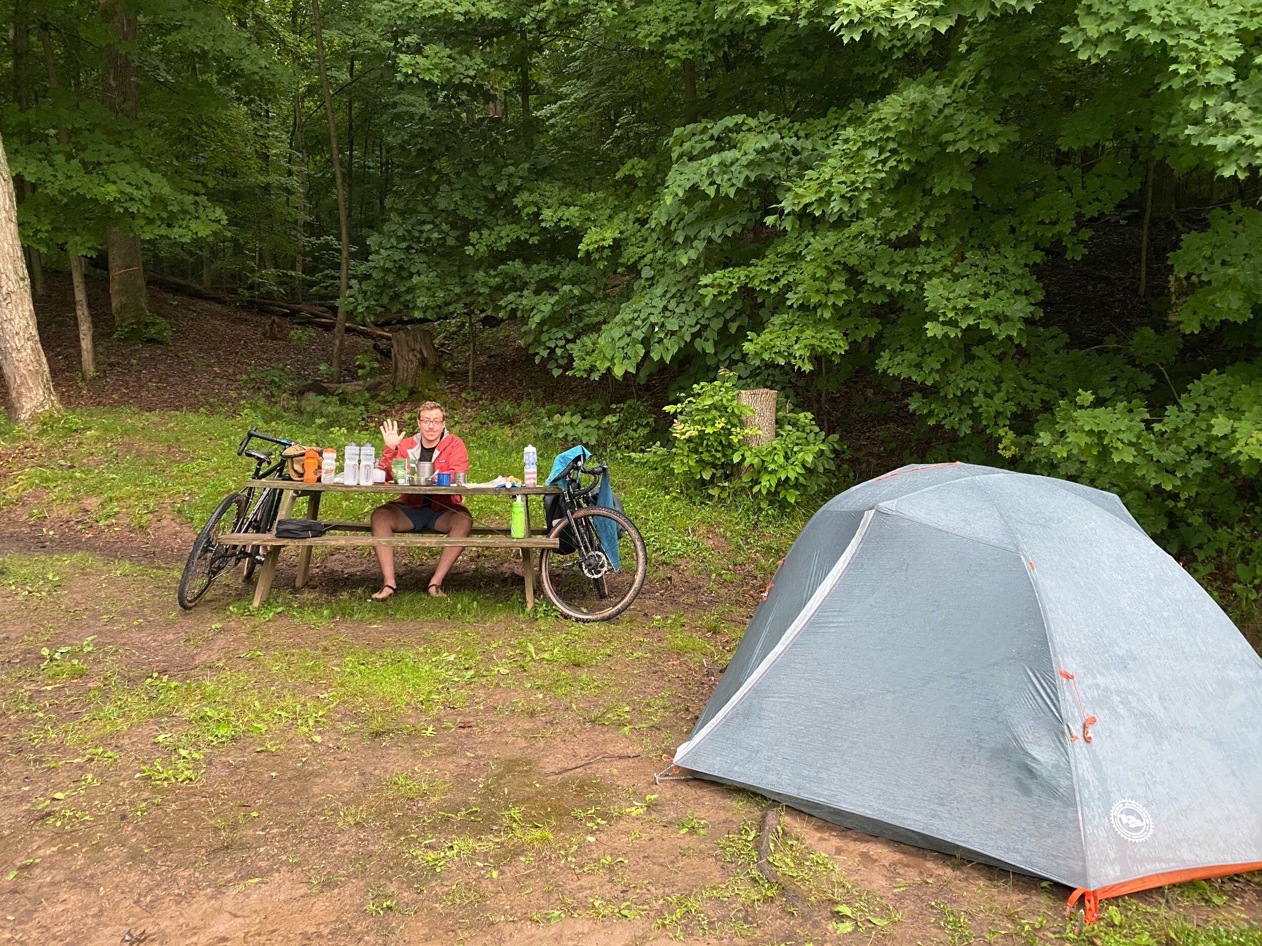
Another morning began with stretching, doctoring up oatmeal with a sprinkling of nuts and dried fruit from our snack stash, shaking the dew off of everything before stuffing it into our bags, and starting the GPS for another ride. I didn’t feel fresh or especially energetic, but I definitely looked forward to the day ahead.
The initial third of our 60-something miles for the day was on highways with more traffic than we had seen so far. The majority of drivers we encountered throughout our trip were respectful and passed safely, but narrow or non-existent shoulders on many of the roads combined with the remoteness of most of our route didn’t provide me with comfort each time we heard a car approaching from behind. Thus, I was relieved when we reached a section of the route that skirted Salt Fork State Park and a short section of closed road near the entrance meant we had the next section to ourselves. A dense canopy of mature trees provided some much-appreciated shade that helped us power up the steady but gradual grade.
Descending on the other side of the park, we entered what would become our low point—in morale if not topography—of the day. We left the shade to find the midday sun overhead and a long stretch of hot, black asphalt before us. We also met a few unfriendly dogs that seemed to appear right when we felt our slowest. In retrospect, though, I am grateful for all of the challenging moments along the way. The unexpected is a big part of the reason we undertake endeavors like this trip, and they make the good parts so much better. That’s the only explanation possible for the sheer delight I felt from the mediocre burger and flat grape soda we found at a truck stop that afternoon.
The final few climbs before reaching camp came and went, not because they were any easier physically but because they just felt like a part of what we did now—a standard part of our evening commute. With our bags unloaded and camp set up, we rode down to Atwood Lake and waded into the cold water to thank our legs for all they’d done so far.
Day 4
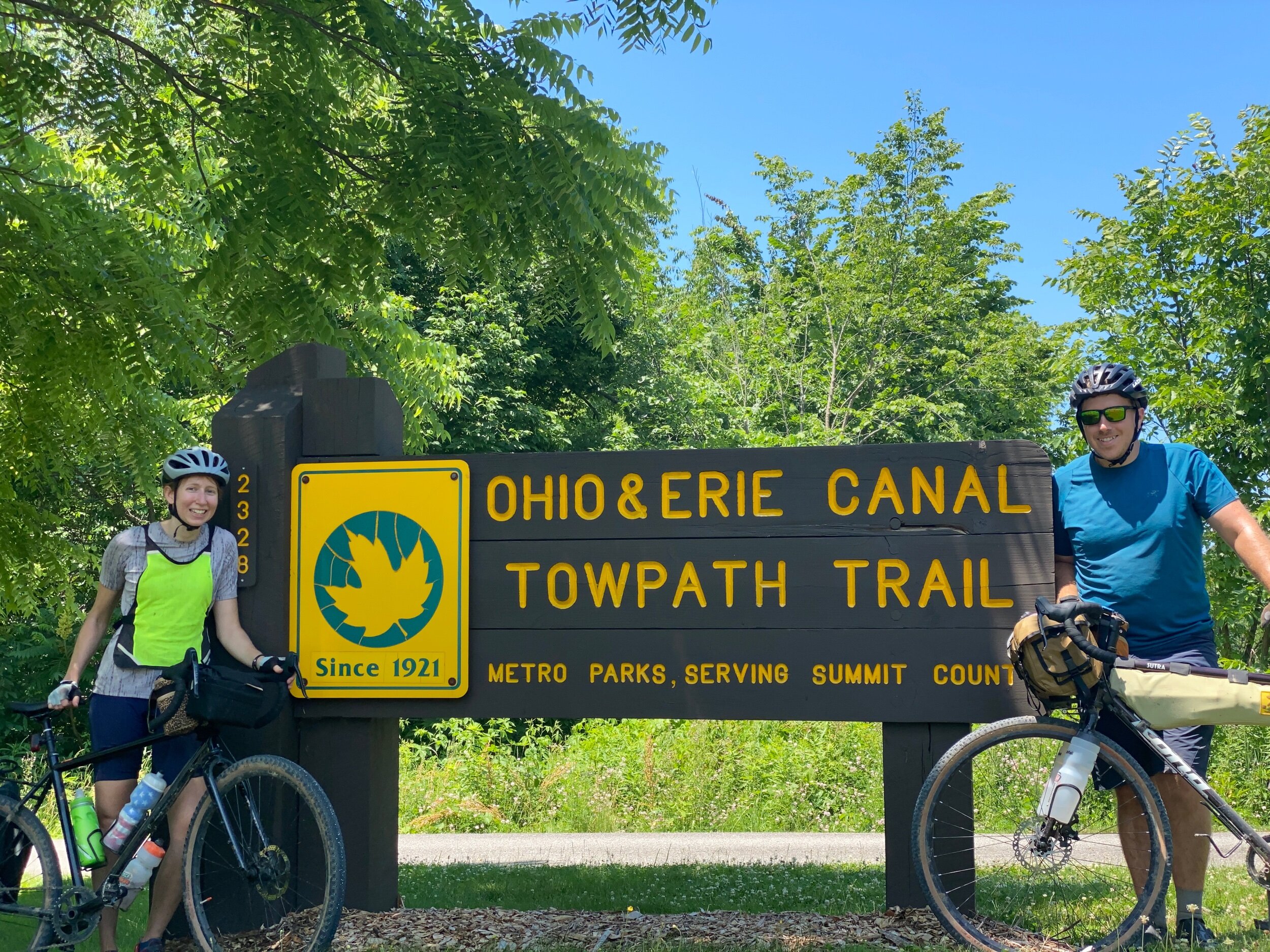
Our final day began with anticipation. It would be our longest day (about 100 miles), yet the final portion promised a subtle but consistent descent to Cleveland. After seven miles on a moderately trafficked highway through farmland, we turned off the road near Zoarville onto a riverside trail. We would spend the rest of the day linking up a combination of trails and towpaths following old canal systems. To start, the trail was little more than sandy singletrack. Our pace didn’t really increase once we left the pavement, but it did feel nice to zip through the trees and put our slightly knobby tires to good use.
As we went, the trail widened and became paved. We passed through several small towns with trailside bike shops and encountered increasing numbers of other folks out enjoying the trail as we neared Akron. Once in Akron, though, we found the trail empty except for scattered goose droppings and feathers. The entire city was seemingly under construction. A good sandwich can make up for a lot, but after trying to approach the deli we found on the map and finding the roads and sidewalks closed from every side, we gave up on Akron completely.
Back on the trail, we made our way into Cuyahoga Valley National Park. A few detours and leisurely snack breaks earlier in the day now meant that our pace would likely put us in Cleveland close to sunset. I felt tired and my body would have appreciated more breaks from the saddle, but the thought of having to finish in the dark was enough to dig deep and push through the fatigue. As we had done the rest of the trip, Frances and I took turns leading and encouraging each other. We made each other better, stronger riders.
I knew from our planning that there were a few optional side trips to waterfalls and other viewpoints within the park, but we stuck to the main route and raced the sun. I would highly recommend building in time to take those side trips (like the one to Brandywine Falls) to anyone else riding this section. Daredevil chipmunks scurried across the path in front of our tires and kept us alert. Exiting the park, hardpack gravel transitioned to pavement and weaved through a series of neighborhood parks. We passed over and under wider and wider highways, offering signs we were nearing Cleveland even before we could see its skyline. Finally, we reached the practical end of the towpath trail system and improvised a route on the safest looking roads to our Airbnb rental. We were done!
I felt such a sense of relief to finish our ride, to take off my sweaty socks, and to sleep on a mattress and pillow that weren’t inflatable. I happily embraced all of the creature comforts available to me once again. Since then, I’ve often felt a deep sense of longing for those long days on a bike with little more than an endless supply of hills and conversations with a human I love. As the pandemic continues to alter what we’re able to do, I’m trying my best to find a better balance and more time outside.


