Diversions
/
Trip Report
Appalachian Gravel Grumble (Part II)
The ride continues and we roll with the punches.
Total Distance
176 miles
Elevation Gain
15,696 ft.
Conditions
1 hurricane

Read Part I: Appalachian Gravel Growler
Day 2
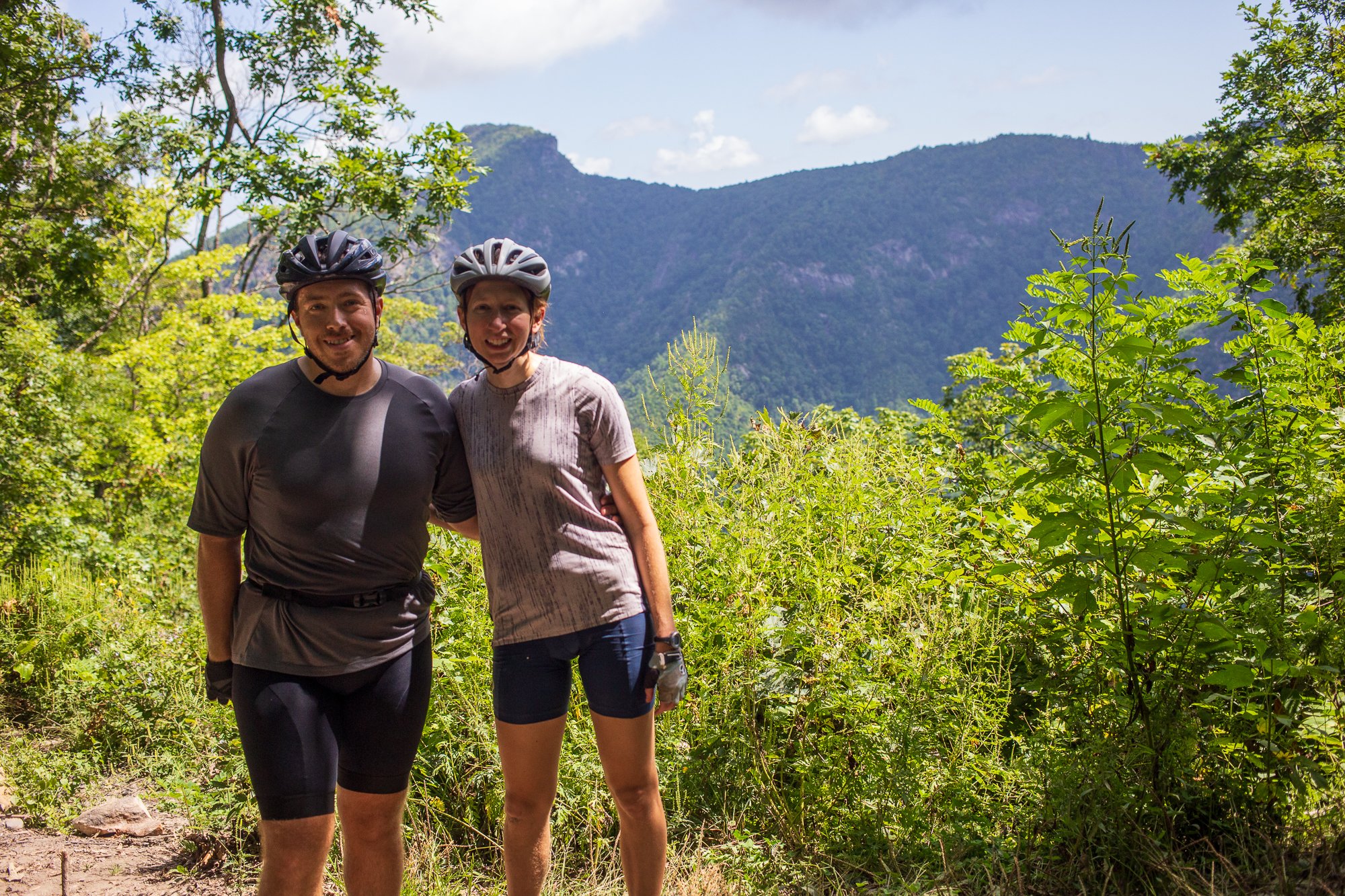
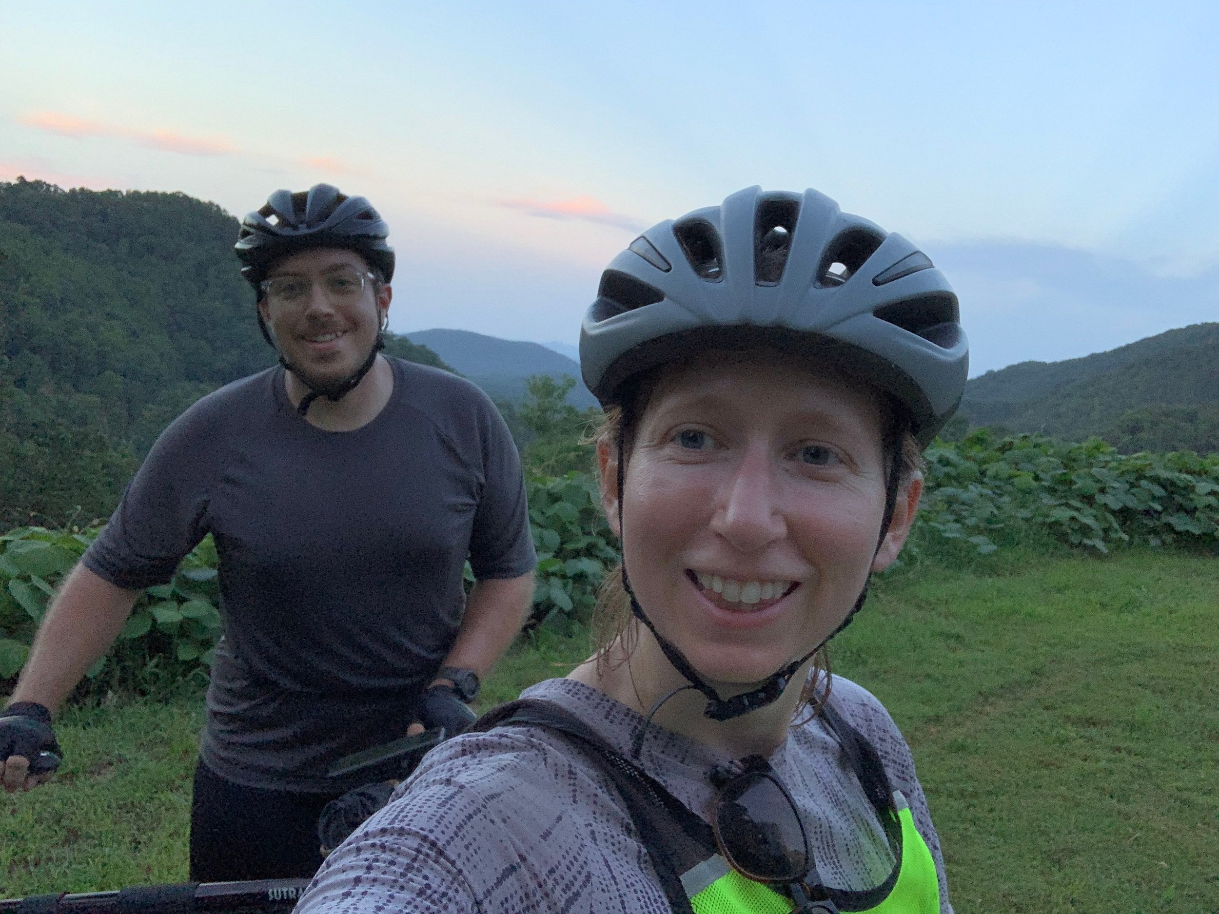
Waiting to camp near where the road tops out the night before paid off on the second morning as we had only a short climb before joining the Blue Ridge Parkway. While the route would put us back on the parkway twice more before Brevard, we had just a handful of miles on it this morning. Knowing we had a big day ahead of us, I lobbied for a stop at Famous Louise’s just off the BRP for breakfast. I suspected it would be the last chance for real food we had until we hit Asheville at the end of the third day. Not far past the restaurant, we found one of those iconic brown Forest Service signs denoting the beginning of Old Hwy 105 which runs along the western rim of Linville Gorge. Despite its name, we had an idea of what to expect from this road: it's nearly all gravel and dirt with some short, steep sections and a sprinkling of large ruts throughout. I traveled it north on my first solo S24O trip (arguably, the harder direction and an achievement I can only believe was beginner’s luck) and we’d both traveled it by car before (which was still not an effortless feat). It was Sunday and there was a fair bit of traffic on Old 105, but everyone’s speed is thankfully kept in check by the terrain. The first few steep descents we navigated along the way were the first real test for our brakes on the trip. They did their job well enough, allowing us to stay out of any holes too deep to roll through and we soon found ourselves near the southern end of the road at a turn that’d take us to the day’s big descent down a power line cut.
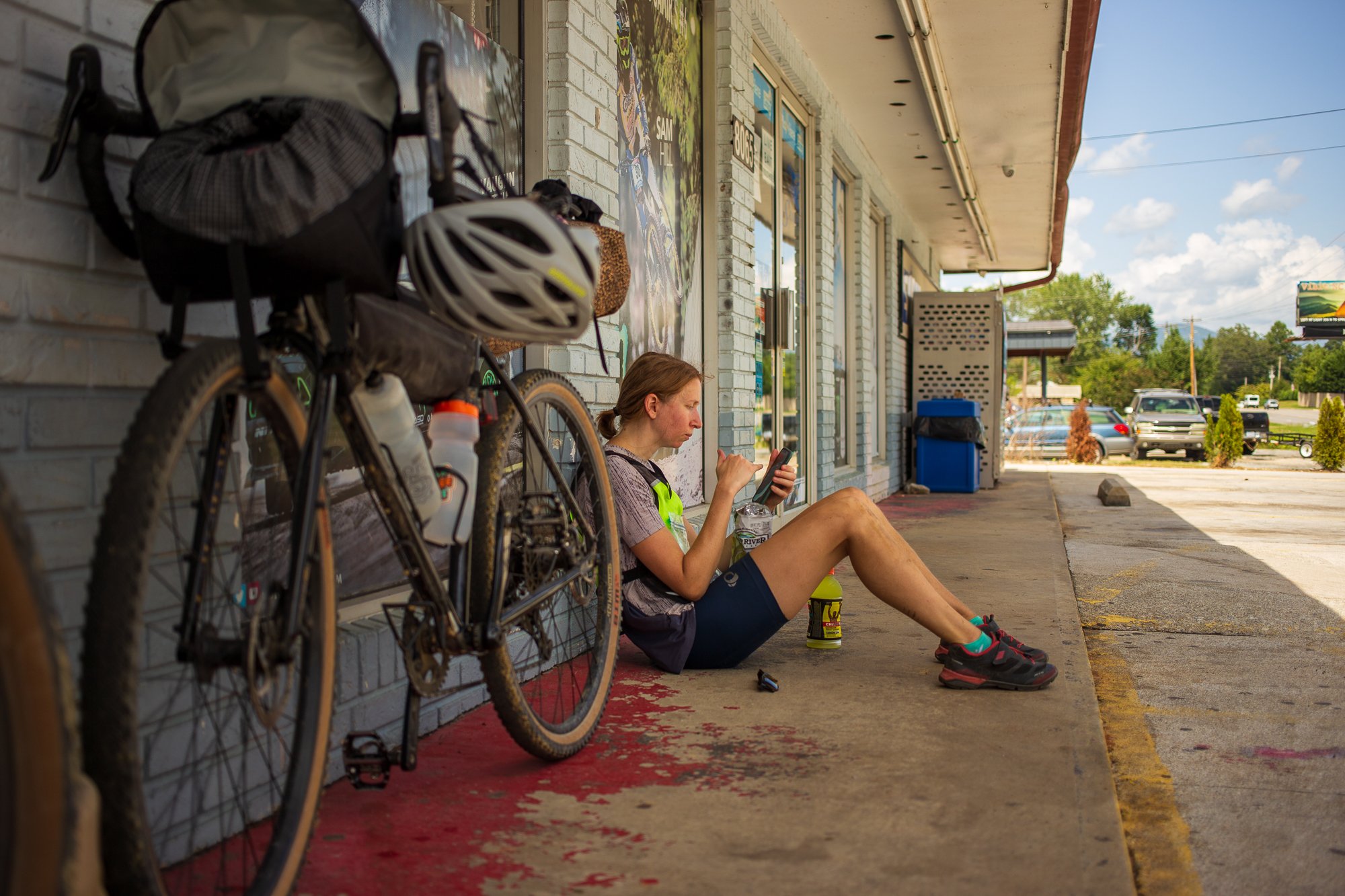
I felt like I knew the roads around the gorge well, but we now entered territory new to both of us. The power line cut was supposed to be one of the gnarlier parts of the route; bikepacking.com described it as the one area where hiking may be required and, before we left, a friend recalled the struggle it had been when he rode the route the year before. They weren’t wrong. By my measurement, this section drops almost 1,400 feet over maybe two miles, averaging about a -13% grade. With no tree cover, the ground is either hard-packed clay or loose and dusty. The grade combined with the weight of me and my load was too much for my brakes, which seemed to lose nearly all of their bite halfway down the cut. What followed was a game involving strategically slowing myself as much as possible with my brakes and steering into the slope occasionally to curb my downward momentum. It probably looked ugly, but we rode nearly all of it. At the bottom, a bit parched and sunburnt from hitting this exposed section near midday, we found our next road and continued on. A few less exciting miles of pavement later, we came to a junction with a convenience store and took the opportunity to sit in the narrow strip of shade at the front of the building with ice-cold Gatorades.
A section of singletrack laid ahead, followed by a moderately trafficked highway before the beginning of a climb up Curtis Creek Road that we’d continue the next morning to return to the Blue Ridge Parkway. The previous section of the ride hadn’t been particularly taxing on my lungs or legs, but it still sucked a lot of my energy and I felt like I was falling behind with hydration. I drank my fill and replenished my water bottles before we left the store, hoping I could avoid completely bonking. After a few more miles in the sun, my morale dipped. I was not feeling strong; I was not feeling ready to hit another gravel climb, though the prospect of getting away from cars again appealed to me. Frank may have been fatigued at this point but she hid it well, playing the role of stoker to keep us rolling. Our ability to play this role for each other when we really need it is something I’ve come to value so much. She kept me going, but I did suggest we take a short and relatively flat detour to the town of Old Fort before we began our climb to end the day. We could grab a coffee at Kitsbow’s Ride House or a bite to eat at Hillman Beer. I don’t know if I thought caffeine or a sandwich would really help me or if I was just putting off a climb I was increasingly dreading, but we decided it’d be worth the side trip after some debate.
We sat over our food at the brewery and looked at each other. I felt shellshocked and had lost my appetite. I felt foolish for thinking I could handle this trip. I started piling up doubts in my head about the next few days. Eventually, I laughed at all of it and the blissful absurdity of what we were doing. I felt pretty awful, but I didn’t not want to be there…with Frank…on a bike…feeling like I’d bitten off much more than I could chew. Deep down, I’d known this trip was going to beat me up. There’s a line somewhere between suffering through a thing in a way you can still enjoy and pushing too far, though. I don’t really know where that line is, but I felt like I was close to it on the evening of our second day of riding. The originally planned way up Creek Road would be the biggest climb of the trip. After the past two days, tackling an even bigger climb now seemed delusional. My more serious concern, though, became water. I’d really struggled on the second day and we’d gotten lucky on the first day by refilling our bottles at some roadside springs we hadn’t necessarily planned to use. We should have been able to filter water from some streams on the initial climb but the only visitor center we’d pass once on the parkway was shuttered due to the pandemic, meaning we potentially faced a 30-mile stretch of road often exposed to the sun without supplemental water. I decided it would cross the line for this trip, and so we began to discuss plan B—or plan C at this point.
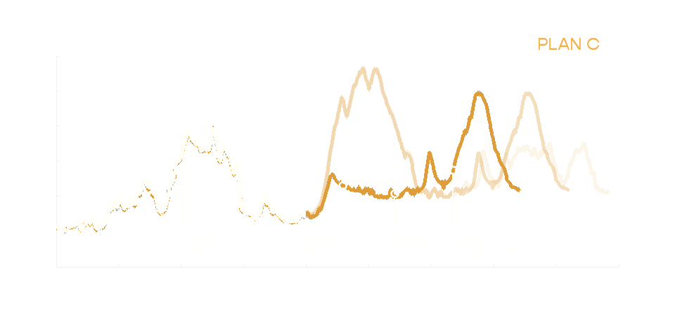
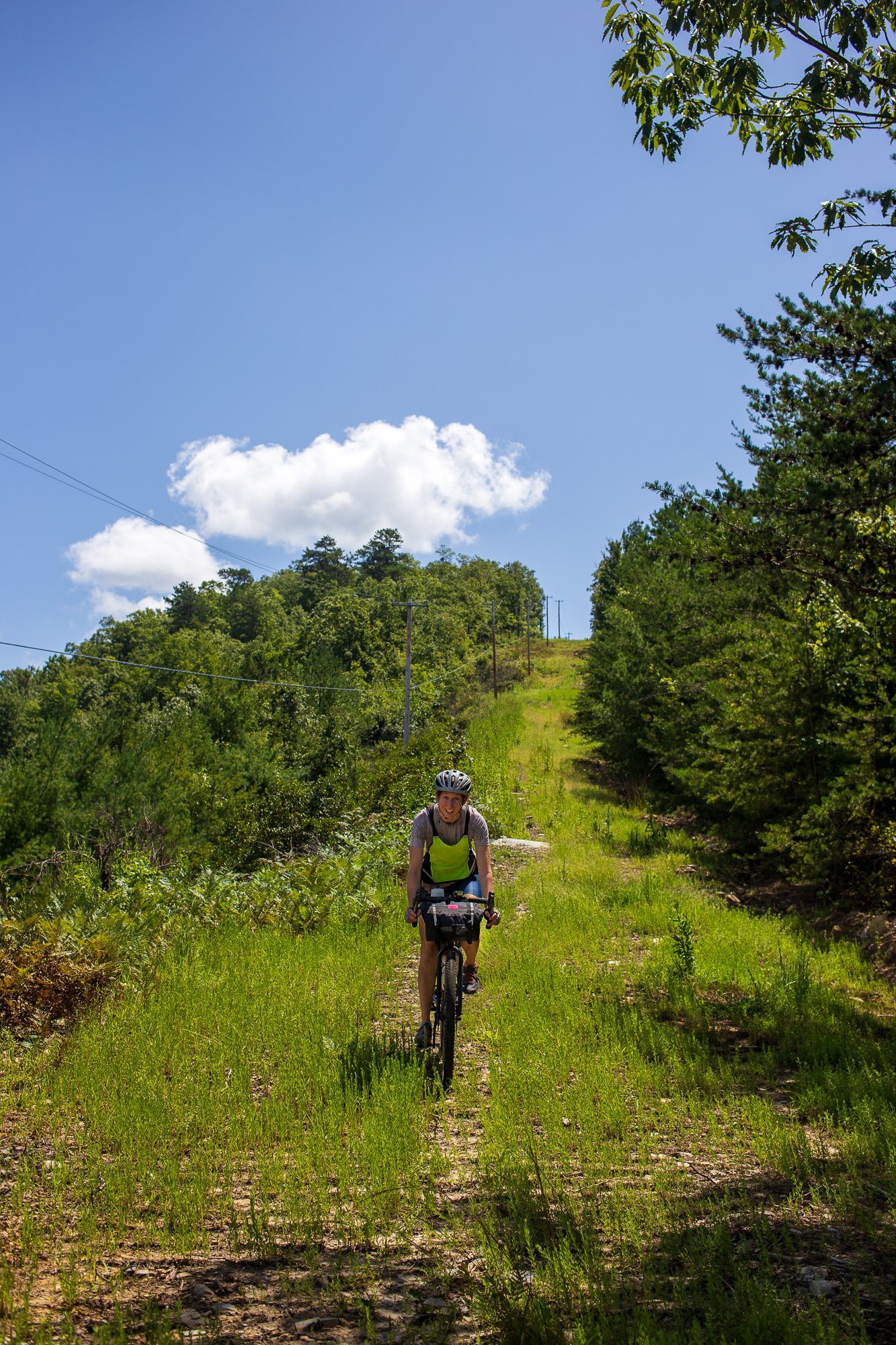
The mountains that made this trip so appealing in the first place also limited the availability of alternate routes to Asheville. The next best option to ascending to the Blue Ridge Parkway, it seemed, would be to follow the Interstate-40 corridor west on side streets. That would cut the 50 miles we had planned for the third day nearly in half and it’d probably diminish the scenery by more than half, but we figured it was the safe thing to do. We left Old Fort and headed west, now aiming to end the day in Black Mountain. We didn’t necessarily need to cover those miles before the next day but after looking for public campgrounds in the area, it was the most logical place to spend the night. We chased the sun up the Point Lookout Trail, a former highway closed to motor vehicles once the interstate opened. In the waning light, we could just make out the path being slowly enveloped from both sides by kudzu. We reached the pass soon—an easy up compared to the climb we had previously planned for the night—and began to roll down to the town of Black Mountain. The air was cool as we descended and I felt almost as if I was floating, no doubt lifted by the euphoria we all feel after canceling plans we realize we don’t want to keep. We coasted the final miles along an access road into the parking lot of a Super 8 we’d call home for the night. The day ended with washing our bibs in the hotel sink and sharing a Little Debbie while sitting on the scratchy blanket covering the bed. It was not at all the night I’d pictured, but it was delightful in its own way.
Day 3
After our big change in plans, we started the third day optimistically. We allowed ourselves a leisurely morning, eating breakfast outside a café before leaving Black Mountain. Some of the other diners noticed our bikes propped up nearby and asked us about our trip. Some were amazed that we’d ridden there from Morganton and one offered that we had a solid relationship if it can withstand a trip like this one. They were right. Under my relief, I still felt some disappointment that I’d wimped out on the original route. What we were doing was still amazing, though, and it’s something most people won’t attempt. Their comments brought me some renewed gratitude for my body, where it’d taken me so far, and where it was yet to take me. We finished breakfast and began the ~20 mile ride to Asheville. We had done our best looking at a map the night before to string together what seemed like the safest roads into the city, but the traffic and stress picked up nevertheless as we neared Asheville. After a couple days spent primarily worrying about the inner struggle to get up and over the next hill, dealing with impatient drivers and some close passes felt bewildering. Thankfully, the miles passed quickly enough and we made our way to the bank of the French Broad River in Asheville by late morning. I had thought the day’s ride would be easy and it felt great to have judged something correctly for once. We’d spend the rest of the day relaxing and preparing for the remainder of the ride.
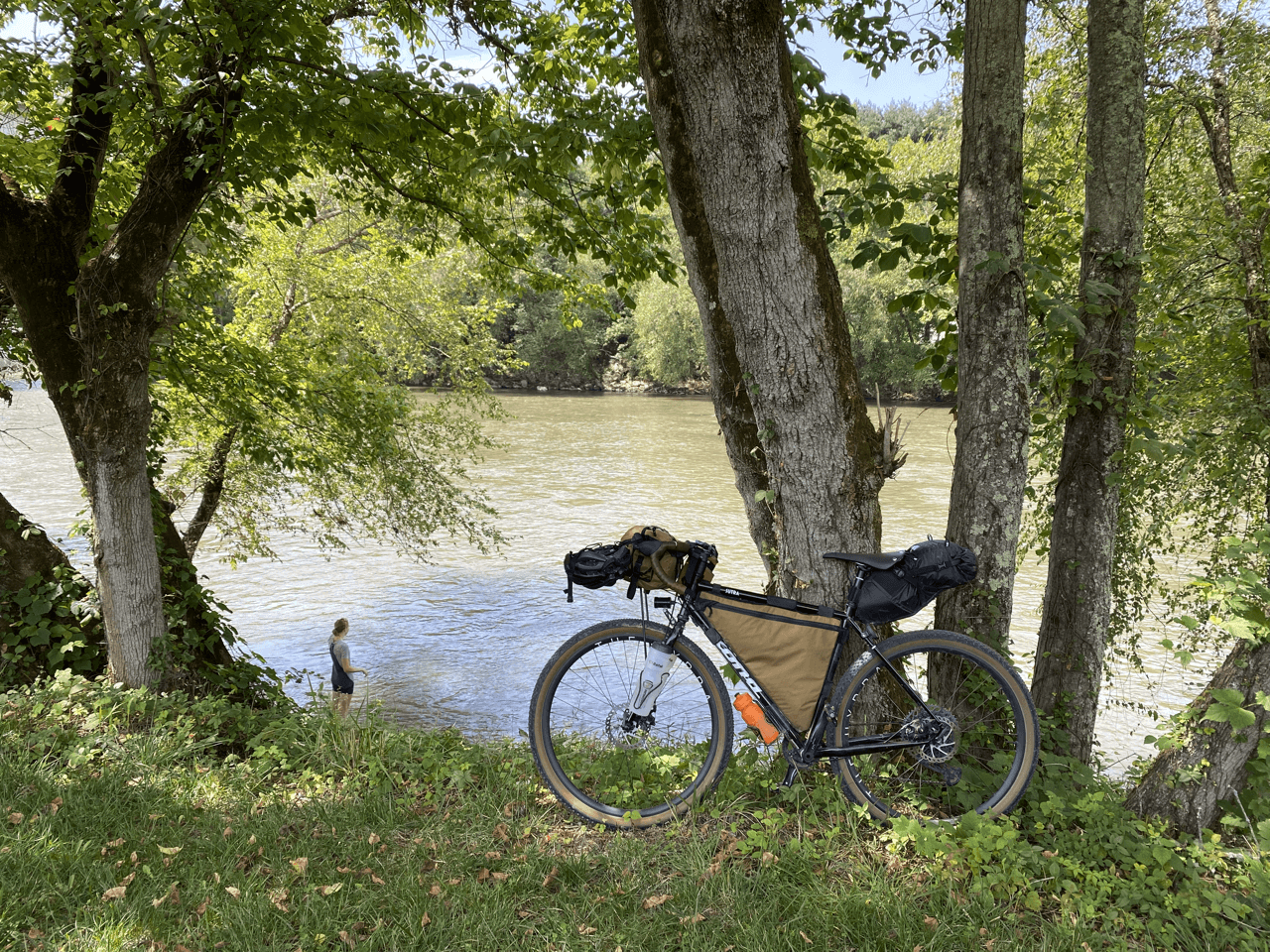
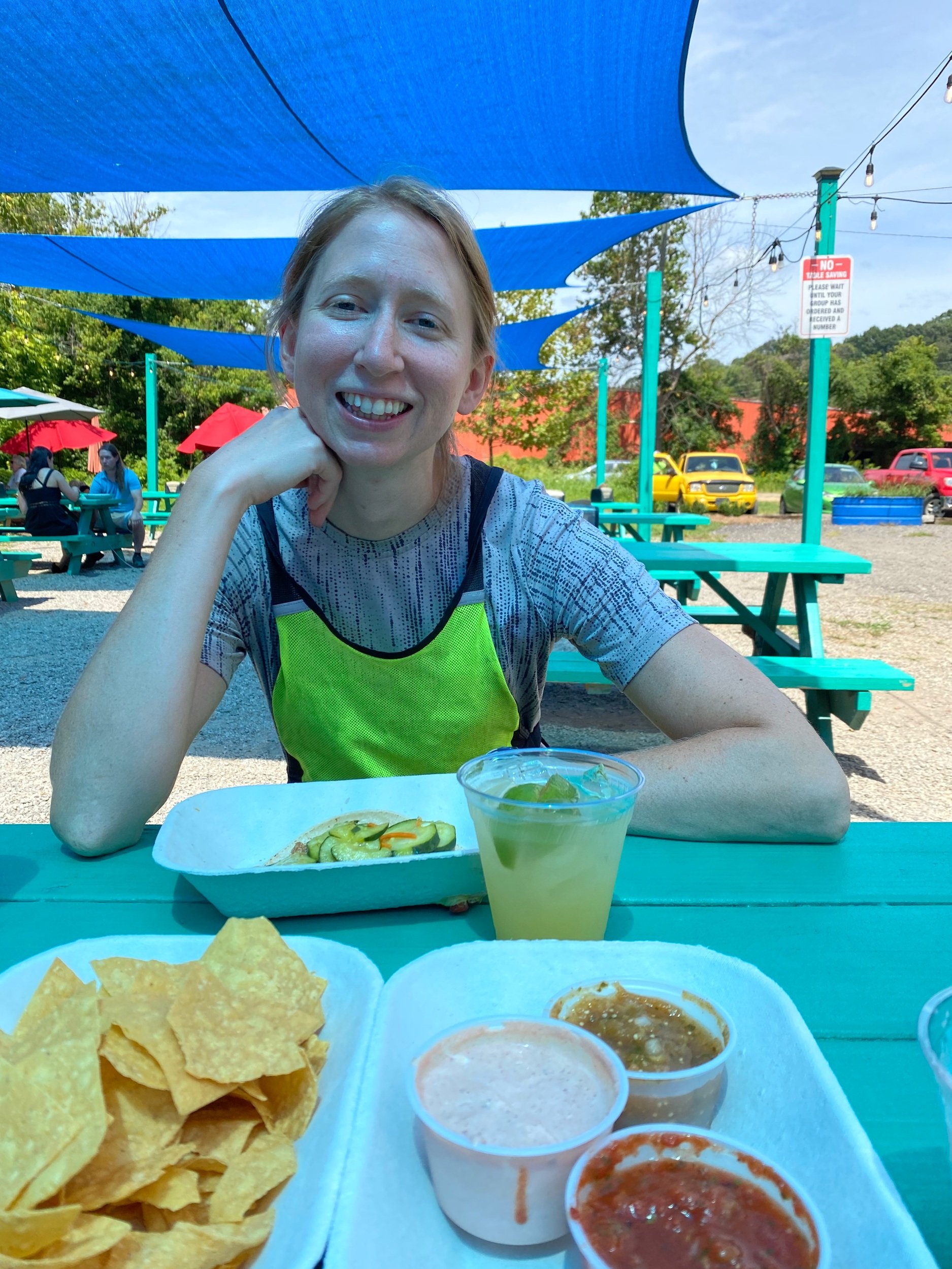
From our shady spot by the river, we wandered over to a favorite taco joint, then eventually to check into our room. We napped, had a beer on the patio, and made plans to meet some friends for dinner later that evening. It turns out relaxing while on vacation can be fun, but it was really the contrast to the past couple days that made it something to revel in. I know I couldn’t find quite the same enjoyment just stepping away from my desk job to lay on the beach for a week. That easygoing feeling would soon be tempered by checking the weather forecast.
We knew there was a decent chance of rain in the final days of the ride as another storm system made its way north from the Gulf of Mexico. That storm was now Hurricane Ida and it was predicted to bring a few inches of rain the following day. I sensed we were both weary of making adjustments, but we also understood the potential consequences of getting caught in this storm. Our planned campsite the following night along the Mills River seemed particularly vulnerable to flooding. After dinner, we again explored alternate routes. We could technically make it to the car within a few hours, but I was desperate to find something else that would feel relatively safe without having to completely bail on the rest of the ride or put us on a busy mutli-lane highway for hours. It looked like we could keep the initial portion of our planned route up to Bent Creek Gap on the Blue Ridge Parkway, then take the parkway south to the Pisgah Inn. The inn is one of the few business located directly on the BRP and it seemed almost too perfect. It’d be about a 26-mile ride from Asheville with a hair over 4,000 feet of climbing. I knew I might be slow on the climbs, but we could make it before the storm was predicted to move in by starting early. We packed our bags, set several alarms, and tried our best to get a few hours of sleep.


